Wabash River Park
“Whether the current of its journey south is languid or swift, whether its surf darkens with the filtered mud or mirror a sky flushed with rose and lavender, The Wabash flows onward, totally alive –– like the town of New Harmony itself ––– reminding us it is an unpredictable river, not a placid, circumscribed lake.”
— Jane Owen
The Wabash River is one of the two great rivers that give Posey County its unique position in the world. The Wabash starts at Grand Lake in western Ohio and flows 475 miles to the Point in Posey County, where it merges with the Ohio.
It was first discovered by native Americans a long time ago. The first known European to find it was the famous French explorer Robert Cavelier de La Salle in 1669. The name comes from the French spelling of the Indian word “Ouabache,” which means “white.” Back then, the river was clear, and many white fossils were visible on its bottom.
In the early 1800’s, the Wabash was an important artery for trade with flatboats and steamers transporting goods and passengers. That’s why New Harmony was so prominent at the time. But with the coming of the railroads, commercial traffic disappeared from the Wabash.
Today, the Wabash is used almost exclusively for recreational boating, fishing, and sightseeing. New Harmony, Harmonie State Park, the Old Dam, and Dogtown Ferry Public Fishing Area and Boat Ramp are publicly accessible spots to catch a sunset, cast a line, or just enjoy watching the river flow.

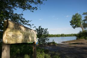 The Dogtown Ferry Public Fishing Site and Boat Ramp is located at the end of a dirt road in a very rural area. It is not well-maintained and is often flooded or very muddy in rainy seasons.
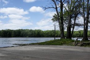 The Harmonie State Park boat ramp offers easy access to the Wabash to the park’s campers.
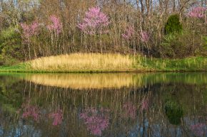 Harmonie State Park offers several great fishing options. One can fish in several ponds near the campground or off the banks of the scenic Wabash River, where a boat launch ramp is also available.
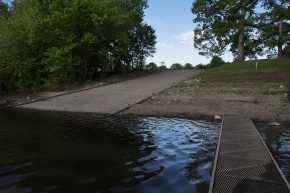 The Hovey Lake Boat ramp provides access to Hovey Lake for boats, kayaks and canoes.
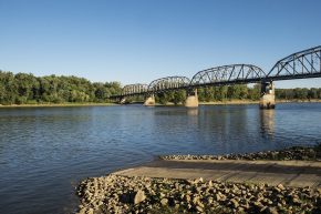 The New Harmony public boat ramp is a great place to put in the Wabash. It’s just a short ways upriver from the Old Dam, right next to the historic New Harmony bridge.
 The Wabash Lowlands is comprised of hardwood forests and several ponds. The area is an important wetland for migrating birds, fish, reptiles, and amphibians. Wading birds such as cranes and herons inhabit the deep ponds and surrounding areas. Native pecan trees and naturally occurring bamboo and cane provide the ...
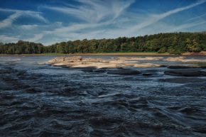 The Wabash River starts at Grand Lake in western Ohio and flows 475 miles to where it flows into the Ohio in Posey County. It was first discovered by Europeans in 1669 by the famous French explorer Robert Cavelier de La Salle while he was exploring the Ohio River. The name ...
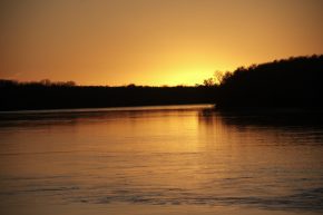 The Wabash River park within Harmonie State Park is one of the nicest spots to enjoy the Wabash. It has a short trail along the river’s steep bank and the sunsets, often spectacularly, at a bend downriver. There are several picnic tables and a nice modern playground.